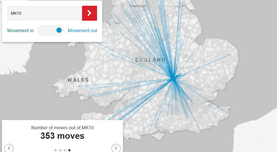
The Royal Mail has analysed over a million redirections between September 2015 and September 2016 to understand the nation’s home moving habits and establish where people move to from any location in the UK. v
 The information can be used by moving companies to establish the most potentially productive areas of the country and their local market share.
Maybe it will come as no great surprise, but the research claims the average distance moved is just 25.83 miles. The longest move recorded was to London from the Shetland Isles, 728 miles. People in the north-west of England prefer to stay close to home, moving an average of just 19.17 miles.
Using the data, the company has built an interactive map that can be searched by postcode to reveal the number of moves in and out of an area and the shortest and longest moves. It can be found at www.royalmail.com/redirection-moving-map. The map provides details of the longest move from a postcode area, the shortest, the average distance moved and, most importantly, the number of moves both to and from an area. By cross checking this with their own customer data it’s easy for a moving company to establish its statistical market share and work out whether this is getting better or worse, year on year.
The information can also be used to establish which areas of the country are potentially most productive and direct marketing effort accordingly.
Jim Conning, Managing Director of Data Services at Royal Mail, said: “Royal Mail redirects millions of letters and parcels every day, making sure that important documents and personal information follow home movers wherever they move to. This map paints a picture of where people are moving to and from providing a unique insight into the distances people travel to find the perfect home.”
Instructions on how to add this interactive map to your website can be obtained from rebecca.maund@royalmail.com.